The Piri Reis Map — A 500-Year-Old Intelligence Document Hidden in Plain Sight
$ 29.00
A documentary investigation into the 1513 Piri Reis Map, examining historical evidence, cartographic methods, and the truth behind claims of lost knowledge, Antarctica, and ancient mapping accuracy.
60+ page illustrated PDF • Ancient history • Cartography • Evidence-based analysis
What if one of the most debated maps in history is not mysterious because it reveals the impossible — but because it has been misunderstood?
The Piri Reis Map is a documentary-style investigation into one of the most discussed cartographic artefacts ever discovered.
Created in 1513 and rediscovered in 1929, this fragmented world map has long been associated with claims of lost knowledge, advanced ancient civilisations, and even the depiction of Antarctica centuries before its official discovery.
Rather than reinforcing speculation or dismissing it outright, this investigation takes a different approach.
Using documented historical evidence, cartographic analysis, and contextual reconstruction, this eBook examines what the map actually represents — and more importantly, how it was constructed.
What emerges is not a mystery of impossible knowledge, but a far more grounded and revealing reality: a document built from multiple sources, preserving competing perspectives of the world at a time when global understanding was still forming.
Inside this investigation:
• The real origins and discovery of the Piri Reis Map
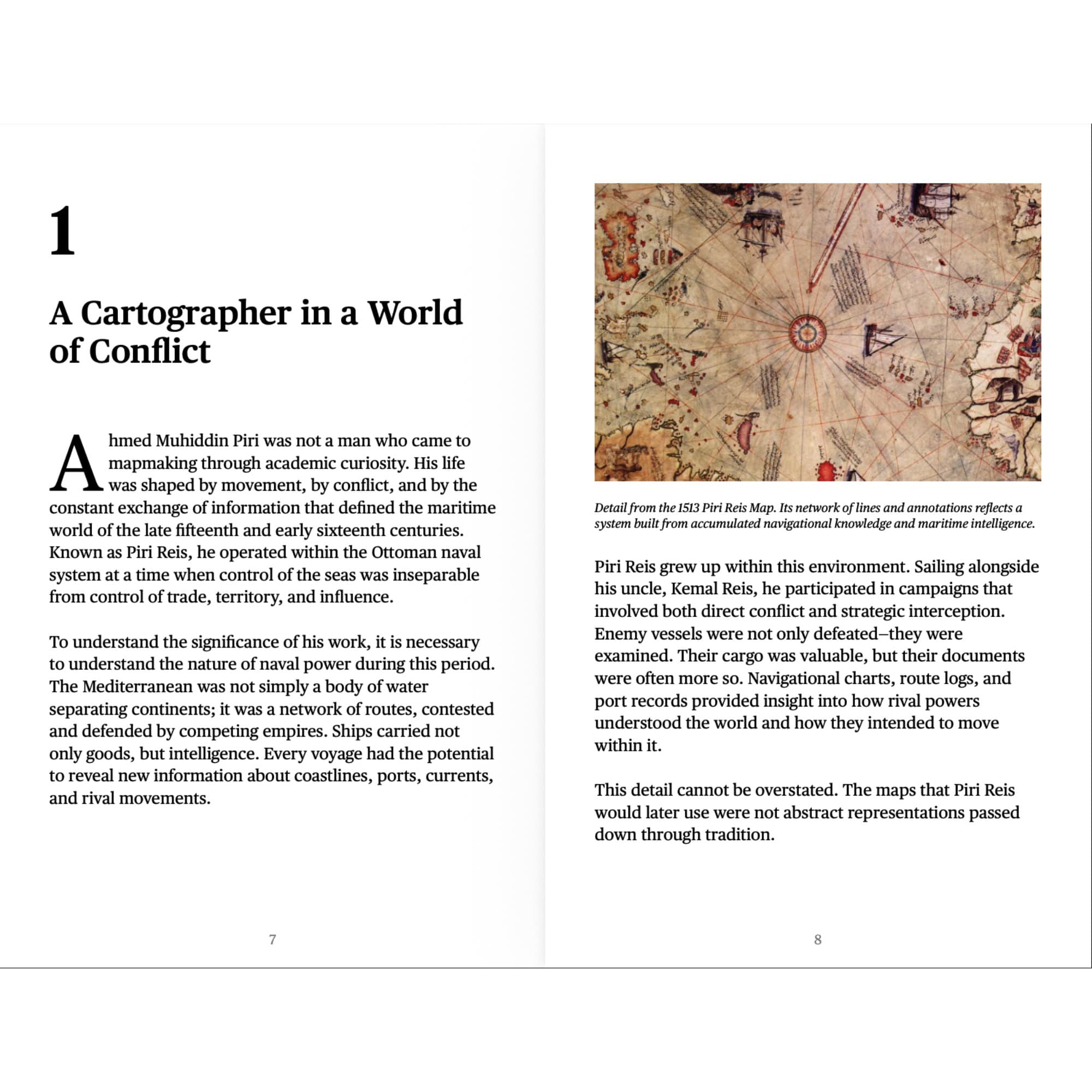
• How early cartographers gathered and used intelligence
• The role of Portuguese and Spanish mapping accuracy
• Why inconsistencies in the map are not errors — but evidence
• The truth behind the Antarctica claim
• How projection, measurement limits, and interpretation shaped early maps
• Why the map is better understood as an intelligence document — not a navigational chart
This is not a theory-driven narrative.
It is a structured examination of how knowledge was collected, interpreted, and preserved during one of the most critical periods of exploration in human history.
The Piri Reis Map challenges assumptions — not about the past itself, but about how we interpret it.
This is a serious, long-form documentary eBook intended to be read thoughtfully — not skimmed.
Format: Digital eBook (PDF)
Delivery: Instant download after purchase
Edition: First Digital Edition


Reviews
There are no reviews yet.